
Verify Bourne Block Parcels
Bourne block research works best as a small set of public relationships around one parcel, not as a claimed household roster. MassMapper supplies the geometry. The Town of Bourne Assessor's Database supplies the assessed owner, mailing address, situs address, and map, block, and parcel reference. The Barnstable County Registry of Deeds can then confirm recorded lot layout, transfers, easements, and deed parties. A town annual register or street list has a different purpose and remains subject to voter confidentiality rules. Each source answers one narrow question.
| Source | What It Shows About a Block | Access |
|---|---|---|
| MassMapper parcels | Adjoining parcel polygons, parcel IDs, roads, water, and optional map layers | Free map, select or identify; data request fallback |
| Bourne property cards | Assessed owner, mailing and situs address, value, and map/block/parcel | Free online card search |
| Registry plans and deeds | Recorded lot layout, owners, easements, transfers, and plan references | Free index and images; address search is an unofficial aid |
| Annual register or street list | Lawfully available name, residence, and precinct context | Clerk inspection or request, subject to M.G.L. c.51 and confidentiality |
| Public civic organizations | Village contacts, projects, and public events | Organization pages; no member rosters located |
| Archives and cemetery material | Historic families, deceased occupants, village files, and maps | Archives or library catalog and appointment support |
An assessed owner can receive tax mail somewhere other than the Bourne situs address, and a recorded owner may not be the current occupant. A voter entry, when lawfully available, is also not proof of every household member. Keep the parcel identifier, the record date, and the source beside each fact. That separates a useful block record from an unsupported conclusion about nearby households.
Read Bourne Parcel Layers
MassMapper's parcel map is pictured below with the type of map and layer context useful for a Bourne block search.
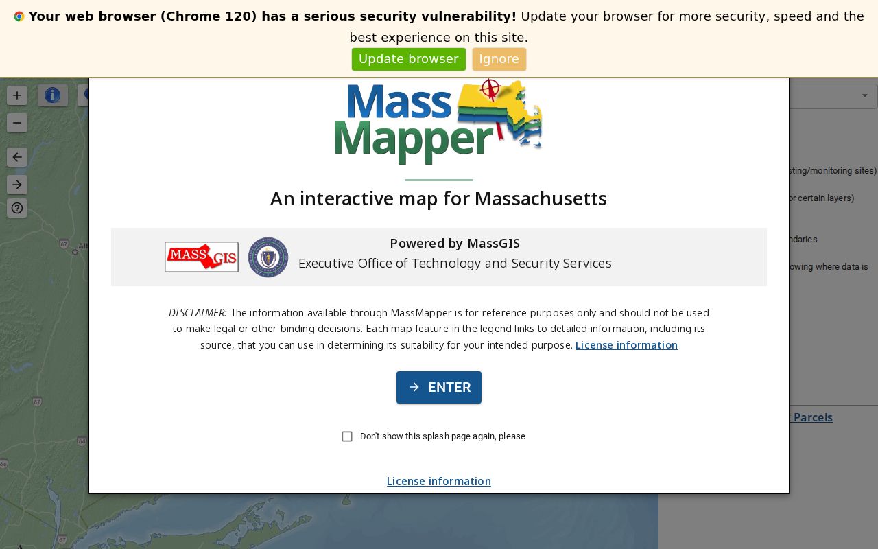
Load the parcel and road layers, search or zoom to the address, and select the target polygon. Road, water, zoning, flood, district, and ZIP layers can help explain the setting, but they do not change a legal boundary. Bourne Engineering also links to MassMapper and publishes assessor, historical, zoning, road-location, and road-ownership maps. When the question concerns a subdivision or an accepted road, Engineering can provide plan-oriented help by phone, email, or in person.
Use the map as a joining tool. Match its parcel ID and site address to the assessor card before recording an adjacent lot. A road right-of-way, canal, shoreline, or municipal line can make two shapes look close while leaving them legally separate.
Note: MassMapper's live control labels and any buffer-radius option were not confirmed in the research, so select or identify tools are the documented starting point.
Compare Bourne Neighbor Parcel Cards
The Town of Bourne Assessor's Database is the local property card route. Its FY2026 system identifies assessments as of January 1, 2025. Search by house number in ST NO 1, then use the first three or four street letters in LOCATION without a suffix. Owner searches accept the first letters of a surname, while a map value follows the letter-hyphen-two-digit form such as A-01. Block and parcel values omit leading zeroes.
- Parcel
- A mapped unit of land used to join the map, assessment record, and title materials.
- Situs address
- The physical property location shown on the card, which can differ from a mailing address.
- Assessed owner
- The owner named for assessment purposes, not a finding that the person currently occupies the property.
- Legal description
- The deed or plan description that controls when street text and parcel labels do not line up.
Results can be searched, sorted, and filtered, but multiple search fields are combined. If a result disappears, remove an extra field before assuming the parcel is absent. Property-card PDFs may require horizontal scrolling to reach their links. The assessor's mailing and situs fields are useful clues for a later Registry search, not a way to label every parcel as owner-occupied.
Map Bourne Blocks and Owners
Use an address-to-parcel process for the immediate Bourne block. It keeps a true boundary question distinct from a name question and creates a record trail another researcher can repeat.
- Find the target address in the Bourne assessor card and record its map, block, parcel, and situs fields.
- Match that reference in MassMapper, then click or select every bordering polygon and relevant corner lot.
- Open each matching property card and keep its assessed owner, mailing/situs distinction, and parcel identifier as separate fields.
- Use the Barnstable County Registry of Deeds name search for a recorded transfer or plan reference, searching a party as grantee and limiting Bourne by date where useful.
- Check a Registry plan or legal description when water, a road, or a subdivision line makes visual adjacency uncertain.
The Registry's legal index is name based and reaches back to 1742. Its address index is expressly unofficial and starts in August 1993, so it is a discovery aid rather than a complete block search. Land Court records begin in 1898. For the full chain along a named road, use the Bourne street directory record path rather than repeating every parcel search.
Use Bourne Voter Records Carefully
Massachusetts' online Find my voter registration status form is for an individual checking personal status. It requires first name, last name, date of birth, residential ZIP, and an agreement checkbox. It cannot produce a map of people near a Bourne address. The state advises a recent registrant to allow two or three weeks and to contact the local election official if confirmation does not arrive.
For historical or civic block context, ask the Bourne Town Clerk for inspection or a defined request for an annual register or precinct street list. M.G.L. c.51 covers the annual-register and street-list framework, while 950 CMR 49 protects confidential registrations. The central registry under M.G.L. c.51 §47C is not a general public file. Ballot choices are never a public household field, and protected voters can be omitted.
Give the Clerk the town, year, precinct, fields sought, and a civic or research purpose. The answer may be inspection rather than a copied file, and the current fee or format should be confirmed with the office. That request is more precise and more respectful of the limits that apply to a street list.
Find Bourne Community Contacts
Public village organizations offer community context, not a list of all nearby households. Their pages can identify projects, events, and a public contact route. The research found no current member roster for the organizations below, so membership or residence should never be inferred from a site visit.
| Organization | Area or role | Public route and limit |
|---|---|---|
| Cataumet Civic Associates, Inc. | Cataumet civic, garden, and harbor projects | Public links and community activity; no member roster located |
| Pocasset Village Association | Pocasset projects, beach and picnic history, civic cooperation | Public history page; no current directory located |
| Scraggy Neck association | Cataumet area events and private amenities | Public community site; no public member list |
| Bourne boards and committees | Town and village civic participation | Town agendas and minutes name participants, not households |
Cataumet Civic Associates' public links page is shown below as an example of the community-contact layer.
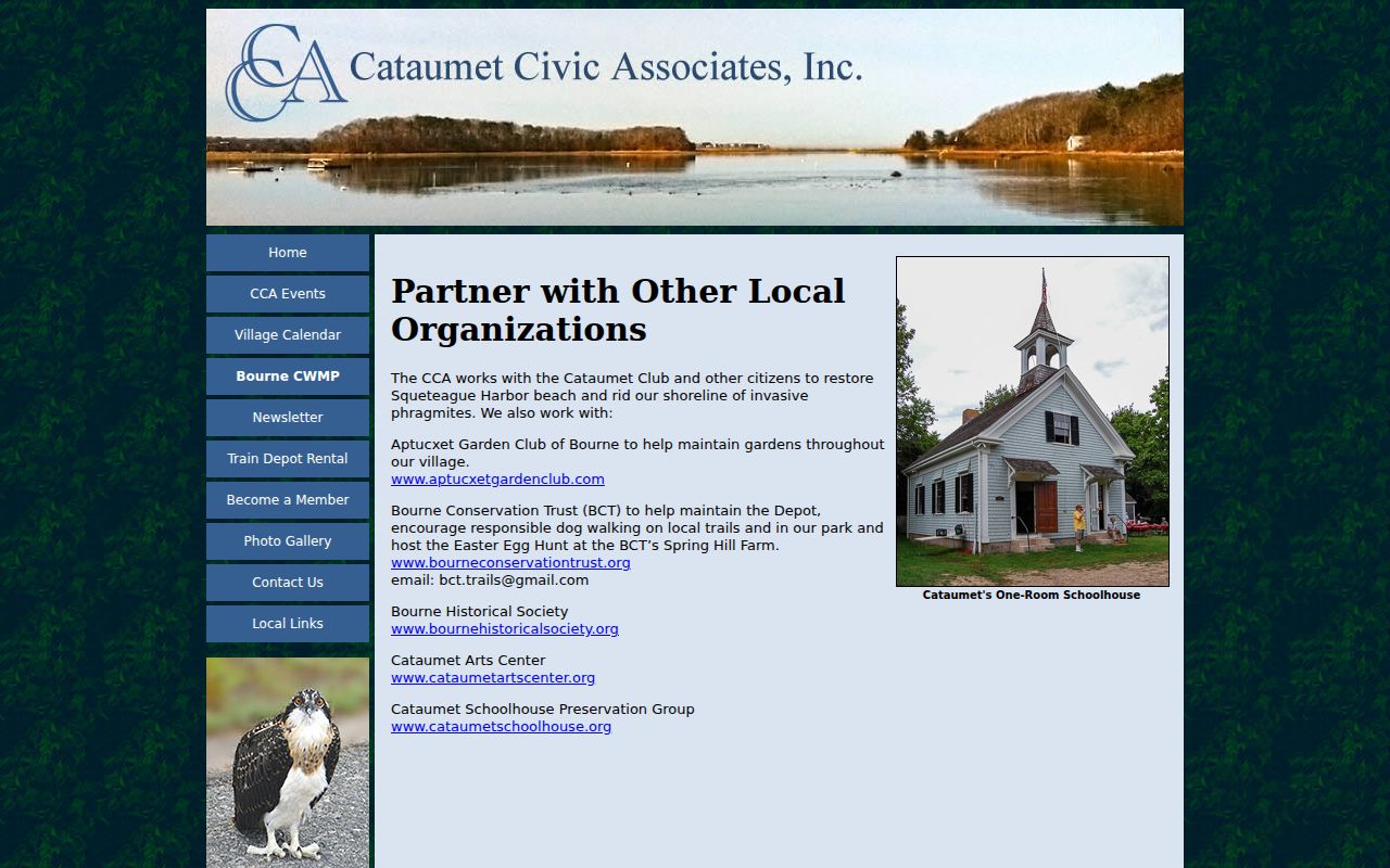
The image supports a public route to civic information, not a claim that a member directory exists. Similar limits apply to the Pocasset and Scraggy Neck sources. Privately maintained association, congregation, and block-watch lists remain nonpublic unless their organization affirmatively publishes a contact directory.
Compare Bourne Neighbor Sources
Official records have a date, custodian, and defined scope. Commercial neighbor tools combine public and marketing data, which can leave a parcel associated with an old address or the wrong person. A source comparison helps keep those categories separate.
| Official parcel and civic sources | Commercial neighbor tools |
|---|---|
| Show a particular public relationship, such as parcel geometry, assessed ownership, a recorded deed, or a lawful street-list entry. | May combine data from different dates and sources into a profile-like result. |
| Can be checked with MassMapper, the assessor card, the Registry, or the Town Clerk. | Need independent confirmation from the relevant public custodian. |
| Carry stated confidentiality limits and a record date. | Can be stale, mismatched, or missing the legal limit that governs the underlying record. |
A recorded grantee, parcel mailing address, postal label, or voter match does not by itself prove present occupancy. That is especially important in Bourne, where the Canal, water edges, and village names can make a simple map view misleading.
Trace Historic Bourne Block Records
For a past block, the Bourne Archives collections bring together town records, family material, maps, cemetery survey resources, village files, and digitized yearbooks. Jonathan Bourne Public Library also offers in-library Ancestry, Fold3, and HeritageQuest. The concrete printed-directory lead is the 1903 A. E. Foss & Co. Bourne/Falmouth resident and business directory, while State Library and NARA sources identify 1900, 1903, 1908, 1926, and 1929 runs.
Historic searches need name and place variants. Before Bourne's 1884 incorporation, the relevant records can be under Sandwich. North Sandwich later divides into Sagamore and Sagamore Beach, West Sandwich becomes Bournedale, Monument becomes Bourne Village, and Head of the Bay becomes Buzzards Bay. The Cape Cod Canal changed geography around 1913, so compare historic maps and legal descriptions rather than expecting a current street label to appear in an old entry.
Note: Archives open hours are limited, so send a targeted surname, address, village, and year request before arranging an appointment.
Respect Bourne Neighbor Privacy
A Bourne neighbor lookup cannot reveal every resident on a block. Renters and household members may not appear in the public property record. Utility, delivery, RMV, sealed court, restricted vital, adoption, and private association information is not a public parcel layer. Massachusetts' Address Confidentiality Program uses M.G.L. c.9A and 950 CMR 130 to provide qualifying participants a substitute mailing address. Confidential voter registration under M.G.L. c.51 and 950 CMR 49 can withhold name and residence from street lists and annual registers.
For a public-record correction or request, use the custodian, the Massachusetts Public Records Law at M.G.L. c.66 §10, the public-record definition and exemptions in G.L. c.4 §7, cl.26, and the regulations at 950 CMR 32. The Registry, Town Clerk, and other custodians decide access under their records and applicable exemptions. An opt-out from a commercial profile does not erase a truthful government record.
Lawful use. Use Bourne block information for personal, civic, family-history, or property context. Public records are not permission to watch, harass, threaten, or expose protected information; Massachusetts law addresses stalking and criminal harassment.