
Bourne Address History by Era
A Bourne house history has several time layers. The Barnstable County Registry of Deeds supplies the title trail, while city directories, census schedules, maps, permits, probate, and Archives collections add household or building context. Each source answers a narrower question. A recorded grantee may be an owner rather than a person who occupied the address. A directory entry may be a dated address association rather than proof of title. Keep the date and the source type beside every name.
| Source | Years It Covers | Where Held | What It Shows |
|---|---|---|---|
| Registry of Deeds index and images | 1742 to present; Land Court from 1898 | Barnstable County Registry of Deeds | Title transfers, parties, legal descriptions, plans, and recorded instruments. |
| Registry address index | August 1993 to present | Barnstable Registry search | Unofficial submitted address text, useful only as a discovery aid. |
| Bourne Town Clerk vital material | Town records 1884-1914 in Archives; current local certificates | Town Clerk, Bourne Archives, RVRS | Birth, marriage, death, and family-link records subject to access rules. |
| Bourne/Falmouth directory | 1903 | Osher Map Library | Resident and business names with address or occupation clues. |
| Combined directory runs | 1900, 1903, 1908, 1926, 1929; catalog leads through 1931 | State Library, NARA, partner libraries | Surname listings and possible house-guide or address sections. |
| Sanborn and atlas material | 1880, 1906; 1913, 1924, 1941, later town and 1962 notations | Town, State Library, LOC catalog | Building footprint, use, streets, materials, lot context. |
| Federal census | Through 1950 under the 72-year release rule | Census, library databases, genealogy repositories | Household composition, ages, relationships, and address geography. |
| Bourne town reports | Online 2006-2025; earlier material with Clerk | Town website and Clerk | Officials, town actions, statistics, and occasional named records. |
| Building permits | Current application and tracking; older cutoff not stated | Bourne Building and Inspection/OpenGov | Construction or alteration dates, permit number, and public applicant detail where available. |
| Probate | Historic index 1686-1950; books 1686-1873; modern cases from 2009 | Probate Court, archives, MassCourts | Wills, estates, heirs, fiduciaries, and property references. |
Start with the era that matches the question. A recent transfer may begin online at the Registry. A turn-of-the-century household usually needs the directory, census, and maps. Very old or oversized Registry records can require office or archive help even though the name index reaches far back.
Fix a Bourne Historic Address
Before looking for past residents, separate the situs address, the assessor mailing address, and the legal description or map-block-parcel identifier. Bourne's assessor card begins with the address and parcel. The deed gives the legal description that controls when the street text changes. A mailing address can be outside town and is not proof that the owner lived at the site.
Historic labels are a major local trap. Cataumet was South Pocasset, Monument became Bourne Village, North Sandwich became Sagamore and Sagamore Beach, West Sandwich became Bournedale, and Cohasset or Head of the Bay became Buzzards Bay. Bourne was incorporated from Sandwich in 1884. Search the predecessor names when the present address produces no historical result, and compare the 1899 and 1937 boundary material when a Canal-era location seems to move.
Note: The Cape Cod Canal altered the landscape around 1913, so a legal description and historic map can be more reliable than a modern road label.
Trace Bourne Address Transfers
The title chain begins with the current assessed owner, then moves backward through the Barnstable Registry's legal name index. The Registry says its title records begin in 1742 and Land Court records in 1898. Its free research images carry a not-official-copy overlay, while clean image prints or downloads use the print cart at the stated per-page fee. Record the book and page or document number, recording date, parties, legal description, plan reference, and linked image for each transfer.
- Search the Bourne property-card system by address. Save the assessed owner, mailing and site addresses, map-block-parcel identifier, and any Registry reference.
- Open the Registry name search, select Bourne, and search the current owner as a grantee within a sensible date range.
- Read the deed abstract and image. Copy the seller or grantor, the earlier deed reference, and the legal description before moving to the next period.
- Search that seller as a grantee in the earlier period. Repeat the sequence, allowing for trusts, corporations, spelling variants, and different village labels.
- When a registered-land certificate appears, use the Land Court certificate and encumbrance search. Use recorded plans or the Registry plan search when a subdivision or lot change interrupts the address trail.
- Grantor
- The party transferring an interest in a recorded instrument, often the seller in a deed.
- Grantee
- The party receiving an interest. Searching a prior grantor as grantee can reveal that person's earlier acquisition.
- Chain of title
- The ordered series of recorded transfers for the same property. It is a title trail, not a complete list of occupants.
- Legal description
- The recorded parcel wording, plan reference, or lot description that identifies land more reliably than a changing street address.
The Barnstable grantor-grantee screen shows the name, party, document, town, and date options used for this step.
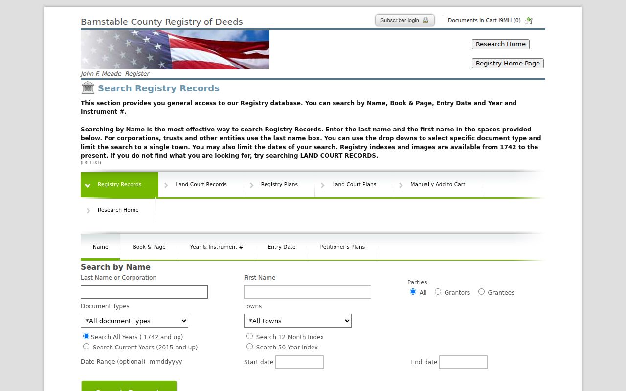
The name index is the durable legal route. It can reach a much earlier deed than an address search, subject to older-record and oversized-plan exceptions.
Bourne Address Index Limits Since 1993
The Registry's address tool can quickly surface a likely record, but it is explicitly unofficial. Submitted property-address text has been indexed only from August 1993, and the Registry does not verify that the text is complete or correct. The search advises omitting a street suffix or entering only its first letter. Use it to get a lead, then confirm the party and deed in the legal name index before calling a link part of a title chain.
The Registry's address-search form exposes property address, document type, town, and optional start and end dates.
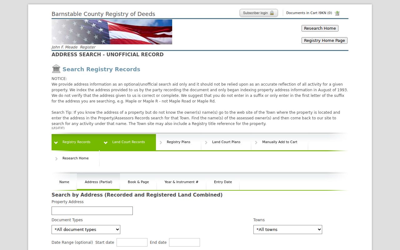
For an older Bourne address, move from the address clue to owner names, recorded instruments, directories, and maps. The 1993 start is not a cutoff for the name index.
Bourne Directory-Year Households
Ownership is only one part of a past household trail. The 1903 Resident and business Directory of Bourne and Falmouth Massachusetts, published by A. E. Foss & Co., is a concrete local starting point. NARA's cataloged combined Bourne directory years include 1903, 1908, 1926, and 1929, and State Library leads add 1900 and 1926. A house guide or street section may appear in some Massachusetts directories, but no official Bourne-specific reverse-directory run was located. Inspect the volume before asserting an address listing.
Use a simple paired flow: directory year and village label → exact surname, initials, address, and occupation wording → census nearest in time → map and legal description → deed or probate confirmation. The 1900, 1910, 1920, and 1930 census years should be read as household snapshots, while the 1900, 1903, 1908, 1926, and 1929 directory runs are separate dated listings. Do not merge them as if they recorded the same day.
The Bourne city directory page identifies the collection shelves and access routes in more detail. For one address, use those volumes only after the deed or map work has fixed the likely village and period.
The Registry's public-access page explains the free index and overlaid research images, plus the clean-print cart.
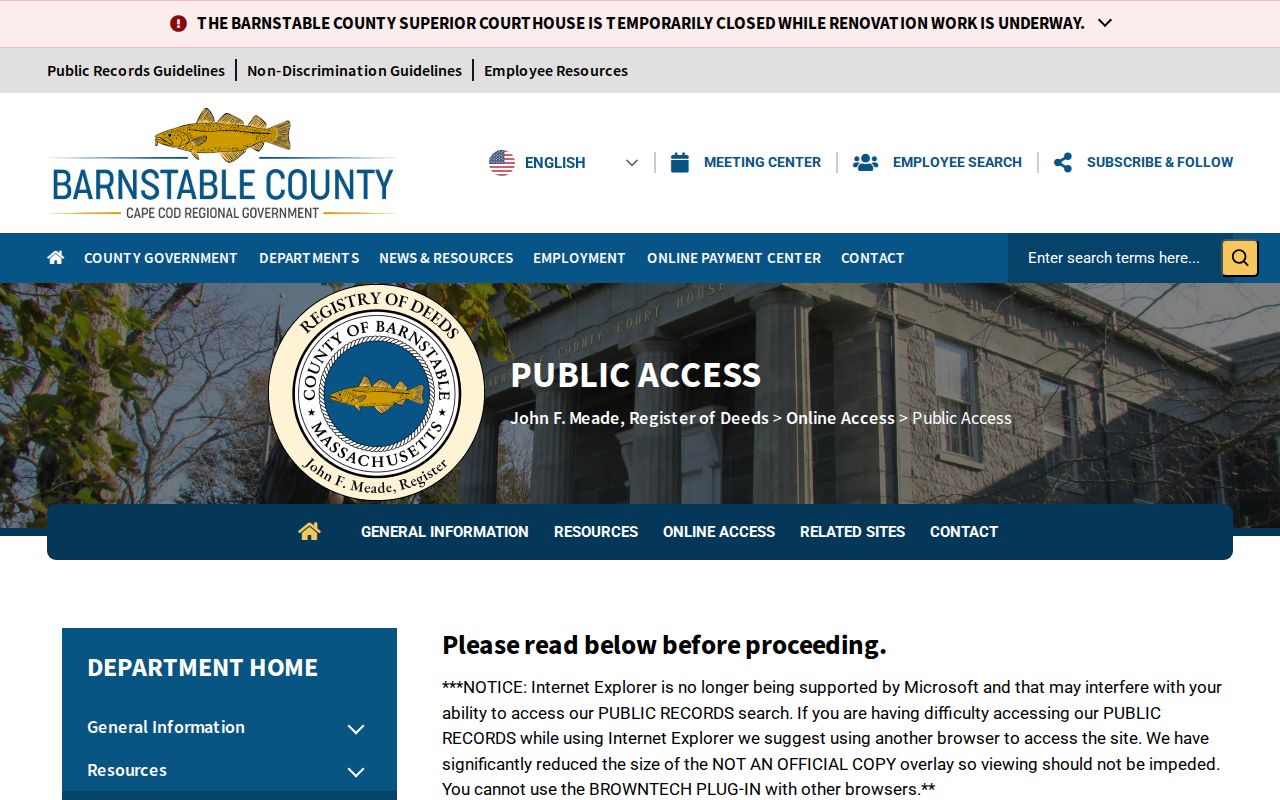
Use a directory or census name as a lead, then return to the Registry, Clerk, Archives, or Probate Court for a record that states the relevant date and relationship.
Bourne Past Residents on Historic Maps
Maps supply the physical context that a deed or directory may leave unclear. Bourne's historical-map page has the 1880 and 1906 Barnstable atlases, 1899 and 1937 boundary lines, and Bourne Sanborn material for 1941-1959. The State Library listing adds November 1913, December 1924, January 1941, and a 1962 holding notation. Use these sheets to date a structure, compare lot coverage, identify public buildings, and test historic street names. They do not name each occupant by themselves.
The Bourne historical-map collection places the atlas and Sanborn sources together.
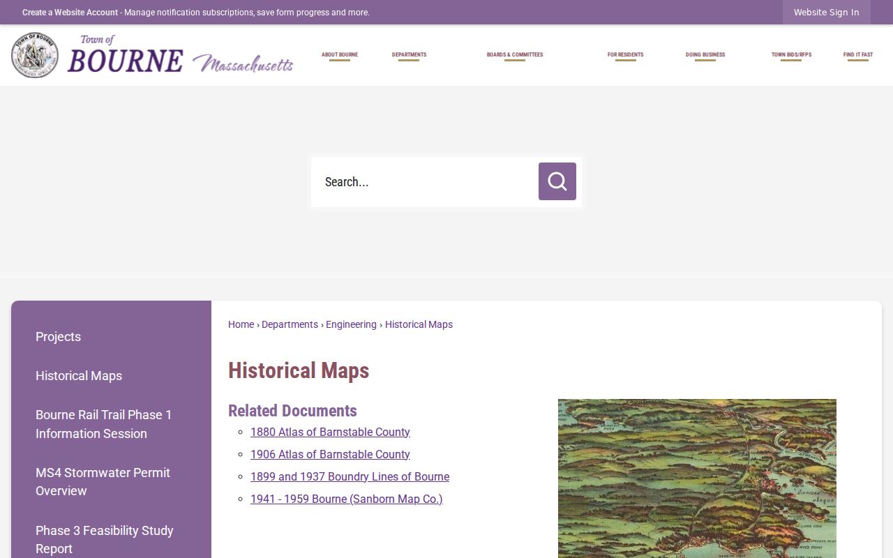
The map date can anchor a house-history gap. Follow it with a directory, census, or deed search rather than treating a building footprint as evidence of a named resident.
Bourne Final Address Records
An obituary, cemetery item, or probate file can close one part of a trail. Bourne Archives holds town records, family collections, maps, cemetery surveys, photographs, oral histories, property material, and digitized yearbooks. Its collections identify Bourne birth, marriage, and death records from 1884-1914. The Archives is open Tuesday mornings with appointments, while the Jonathan Bourne Historical Center lists Tuesday hours and appointments. Contact the repository before visiting for fragile originals or a family collection.
For estate matters, Barnstable's historic probate index covers 1686-1950 and record books cover 1686-1873; modern estate cases from 2009 are searchable through MassCourts. An estate can identify a fiduciary, heir, property reference, or transfer date. It cannot by itself prove that every named heir lived at the address.
When a municipal file is not online, ask the Bourne Town Clerk or Records Access Officer for one existing record, date range, address or parcel, and needed fields under the Massachusetts Public Records Law, M.G.L. c.66 §10. For historical collections, use the library or Archives catalog, phone, email, or appointment process instead of a general public-records request.
Lawful Bourne Address-History Research
House history, genealogy, reunion research, estate questions, and a dated property trail are appropriate reasons to compare public records. Use only the minimum fact needed for the question. A map, assessor card, or deed may establish a parcel relationship, while protected voter records, utility customer information, sealed filings, and restricted vital material have separate limits. Massachusetts also provides address confidentiality and confidential voter protections for eligible people.
Lawful personal use. Bourne address history is for personal, historical, family, and estate research. Do not use a public record to stalk, harass, threaten, or track a living person.
For a correction or protection issue, contact the custodian that maintains the record. Source minimization protects both the person being researched and the integrity of a careful historical trail.