
Walk a Bourne Street by Address
A Bourne address-record search can trace the public records associated with one address, then repeat the method along nearby parcels. It begins with the assessed parcel, not a claim that every person on a street will appear. The site address, map-block-parcel key, owner name, and legal description each unlock a different record. Keep the source date with every result because a tax card, deed, permit, and old directory record different moments.
Use the Bourne address as a starting point, then let the public record determine the next step. The method produces an owner and title trail most reliably. A lawful annual-register request or historical directory can add a dated civic or household lead, but neither replaces the property chain.
- Enter the street number and partial location in the Bourne property-card system.
- Record the assessed owner, situs, mailing address, map, block, and parcel.
- Locate that parcel in MassMapper and compare the geometry with adjacent lots.
- Search the assessed owner's name as grantee in the Barnstable Registry, then read the deed for the prior party and legal description.
- For an earlier household question, compare a dated directory, census, or Clerk and Archives material using the historical village name.
Bourne Street Directory Input Rules
The Bourne property-card instructions make an address search more precise. Put the house number in ST NO 1. In LOCATION, use only the first three or four letters and omit Street, Road, and similar suffixes. An owner-name query accepts the first letters of the surname. Map format is a letter, hyphen, and two digits, while block and parcel numbers omit leading zeroes.
Search fields are combined. Remove an old value before broadening a search. When a result appears, look for the card link, sometimes at the far right of a results table. The assessed mailing address is not the situs address and can lead outside Bourne. It is a tax-notice destination, not a declaration of present residence.
| Field | How to use it on a Bourne street search |
|---|---|
| ST NO 1 | Enter the house number only. |
| LOCATION | Use first 3-4 letters; leave off the street suffix. |
| OWNER NAME | Start with the first surname letters and review the returned parcels. |
| Map | Use a letter-hyphen-two-digit code such as A-01. |
| Block and Parcel | Enter both without leading zeroes. |
The property-card search page documents the format used for this Bourne address workflow.
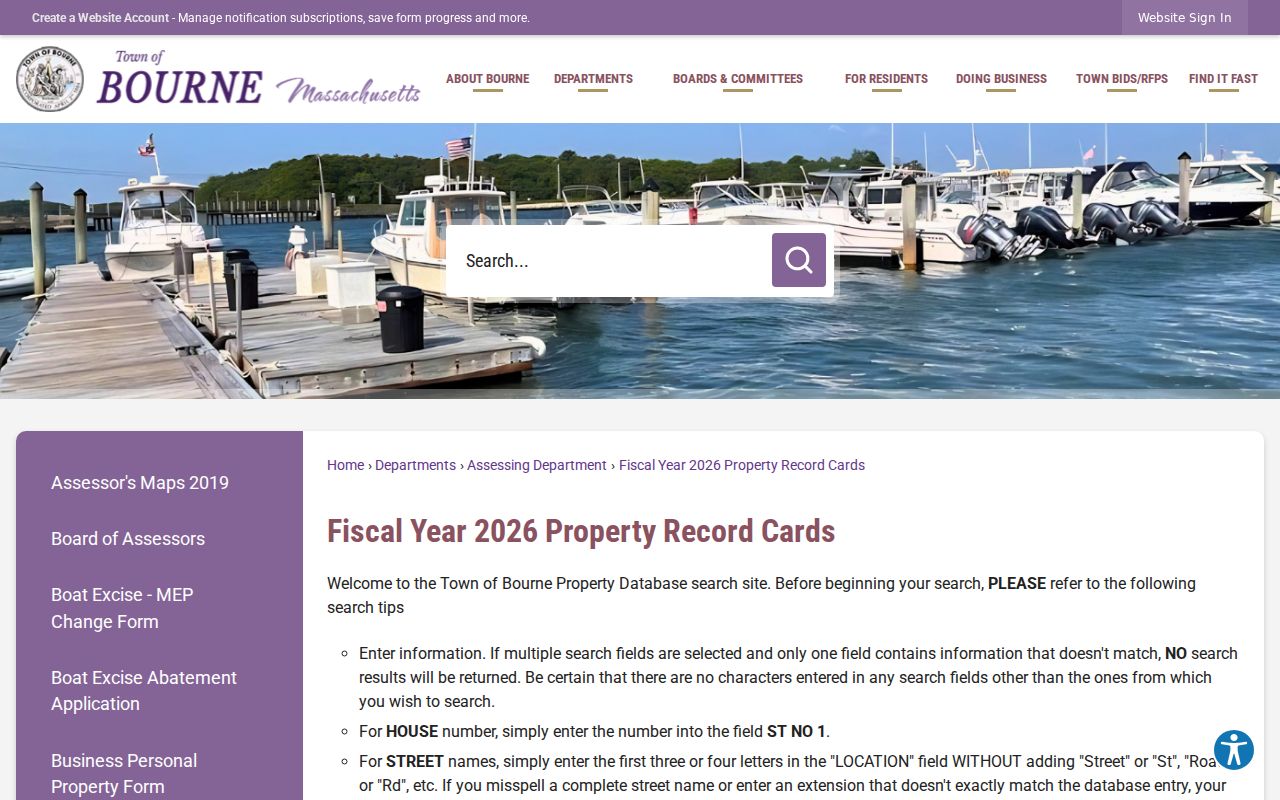
The instructions make clear that a clean partial-address query is more useful than piling unrelated fields into the same search.
Bourne Parcels Along the Street
MassGIS MassMapper is the map layer in the Bourne street-record chain. Load parcel and road layers, zoom to the street, then use select or identify on the parcel. Compare the map shape and parcel identifier with the assessor card. Pan to adjoining polygons rather than inferring legal adjacency from a postal sequence. Roads, water, and a municipal boundary can make two sites look close without sharing a lot line.
Bourne Engineering also links assessor, historical, zoning, road-location, road-ownership, and other maps. Engineering holds many accepted-road layout plans and can provide a phone, email, in-person, or public-record request route when a published map is too thin. MassMapper is a strong orientation tool, but the recorded plan and legal description control a boundary question.
- Parcel
- A mapped unit of property tied to an assessor identifier and, often, a legal description.
- Situs address
- The physical property location used by the assessor, distinct from the owner's mailing address.
- Plat or recorded plan
- A survey-based document showing lot and road layout that is recorded or held by the responsible office.
- Criss-cross directory
- An address-organized directory section, if a particular historic volume actually contains one.
Bourne Street Directory Record Sources
Address-keyed records each answer a narrow question. A parcel card supplies the tax and physical-property view. A GIS map supplies shape and nearby lots. A deed supplies title parties and a legal description. A permit can date work. A town annual register can be inspected only within its legal access rules. Keep those categories separate when reviewing names along a Bourne street.
| Bourne address source | Keeper | Street record use | Access channel |
|---|---|---|---|
| Property card and assessment database | Bourne Assessing | Owner, mailing and situs addresses, parcel, value, structure | Free portal, office contact |
| Parcel and map layers | MassGIS / Bourne Engineering | Parcel adjacency, roads, zoning, flood and district context | MassMapper, town maps, data request |
| Deed and plan index | Barnstable Registry | Title transfers, easements, lot layout, document dates | Free index/images, counter or mail support |
| Permit or inspection file | Bourne Building and Inspection | Work, application, or inspection trail where public | OpenGov route, staff or RAO follow-up |
| Annual register or street list | Bourne Town Clerk | Defined historical civic record | Inspection or request subject to confidentiality |
Note: A parcel ID is the durable join key when street text, postal label, or village name changes across records.
Bourne Street Deed Chain
The Barnstable Registry research home offers the stronger title check for a Bourne address result. The legal index is name based, not a complete address database. Search the assessed owner as a grantee, limit to Bourne and a useful range, open the abstract or image, then capture the recording date, document number or book and page, parties, legal description, and plan reference. The seller is the next name to search as a grantee in the earlier period.
The Registry's address aid starts in August 1993 and is expressly unofficial. Use it to discover a likely recent document, then confirm the chain by name. Its long legal index reaches back to 1742, and Land Court material begins in 1898, though very old or oversized items can take an office or archive follow-up. Free images have a not-official-copy overlay; clean prints use the Registry cart and its published fee schedule.
Bourne Plans and Permit Evidence
Building, electrical, plumbing, gas, and mechanical applications route through Bourne Building and Inspection's OpenGov or Viewpoint system. The published material says an applicant needs an account and can track a submission, while inspection requests go to staff. The public history-search interface and exact filters were not confirmed in the research, so an address and permit number should be taken to the department rather than assuming all past files are searchable online.
Engineering is a complementary Bourne address-record source. It holds many accepted-road layout plans and town-associated subdivision plans, while Registry plan records may connect a lot to a book and page. Plot plans are normally with Building and Inspection. Septic records can help orient a site through the Board of Health, but they are not a substitute for the recorded boundary evidence.
Bourne Address Record Time Checks
Time is the key distinction in a Bourne address search. The FY2026 assessor system describes assessment facts as of January 1, 2025. A Registry result has a recording or entry date. A permit has an application, work, or inspection date. A directory and census capture their own historical moments. A former owner can remain on a tax record for the assessment date, while a later deed records a transfer. Write down the date before comparing names.
For earlier Bourne addresses, add the 1903 combined Bourne/Falmouth directory, the cataloged 1900, 1908, 1926, and 1929 directory leads, and the town's historic maps. The 1880 and 1906 atlases and Sanborn material from 1913, 1924, 1941, and later town-linked years can show a street or structure context. They do not name every resident. Pair a map with a dated directory or census, then use a deed or probate record to test a longer ownership trail.
Bourne Street Record Fallbacks
When a portal does not return the needed street record, use the keeper's other channel. The Registry offers counter and assistance routes for exceptions. Bourne Engineering can supply plan help by phone, email, or in person. Building and Inspection can identify the proper permit path when public web filters are unclear. The Town Clerk can receive a focused public-record request for an existing municipal file, and the Archives or library can help with historical material by appointment or reference contact.
A useful request names one address or parcel, the file category, a date range, and the preferred form of inspection or copy. Under the Massachusetts Public Records Law, a custodian need not create a new street-wide compilation. This narrow approach is more likely to identify a relevant public record and respects the limits built into each Bourne street-record source.
Bourne Historical Street Map Context
Historical maps are an important check when a Bourne street-record result seems out of place. The Town's map collection links the 1880 and 1906 Barnstable atlases, 1899 and 1937 boundary lines, and Bourne Sanborn material. State Library records add Bourne Sanborn editions from 1913, 1924, 1941, and a 1962 holding notation. These sources can show a road, lot, structure, or village setting at a particular date.
Maps do not establish who occupied a property. Use them beside a recorded deed, directory entry, census, permit, or town record with a matching time period. The Canal and the older Sandwich place names are strong reasons to retain the map's original label and the deed's legal description in a research note. That combination can explain why a modern Bourne address does not appear under the expected form in an earlier record.
Bourne Address Record Limits
Bourne public address records cannot identify everyone behind every door. Private utility and delivery accounts are not public address rolls. DMV data is restricted by the federal Driver's Privacy Protection Act. Address Confidentiality Program participants, protected voters, sealed court files, and restricted vital or adoption material have additional protections. An assessed owner, a public civic record, and a recorded party all describe different relationships to the address.
Use an address trail for personal, lawful family, history, estate, property, safety, or civic questions. Contact a custodian for correction or access help when a result conflicts with another dated source.
Lawful use. Bourne street and parcel records are not permission to stalk, harass, intimidate, or harm any person; Massachusetts law addresses stalking and criminal harassment.
Bourne Village Names on Streets
Bourne streets can carry more than one historical place name. North Sandwich became Sagamore and Sagamore Beach; West Sandwich became Bournedale; Monument became Bourne Village; Cataumet was called South Pocasset; Cohasset and Head of Bay became Buzzards Bay. A directory or Registry search that misses the current village label should be repeated with the older term.
Bourne was incorporated from Sandwich in 1884, and the Cape Cod Canal changed the physical landscape around 1913. A road or home description can therefore be more stable in a recorded plan or legal description than in a modern display address. For a long past-address question, use the historical volumes and map evidence described in the Bourne city directory rather than forcing modern street language onto an old book.
Bourne Street List Boundaries
Massachusetts' voter-status form is for an individual to check their own registration with name, date of birth, and ZIP. It cannot be used as a public Bourne street-list scraper. Annual registers and street lists have public-inspection rules under M.G.L. c.51, while central voter data is restricted and confidential registrations are withheld. Ask the Town Clerk for the defined year, precinct, and access method.
Historical directories, census, and Archives material can add a dated household lead. The State Library says some Massachusetts volumes have house guides, but no Bourne-specific reverse directory was confirmed. Inspect the actual 1903 combined Bourne/Falmouth volume before saying it has an address section. Names in a directory, annual register, or permit are associations with the dated record, not a complete household inventory.